Rocky Mountains Near Cranbrook

Wednesday 6 July 2011

Day 38, July 6th, Owen Sound to Toronto!! (196km)

CN Tower Toronto
It rained hard last night.  At quarter to 4, the rain started pelting my tent like a thousand drumsticks.  Then the lightning started.  First, it was comfortably far away.  Then  it got close, really close.  The bolts were so bright, I could feel the heat.  Simultaneously, thunder roared.  I kind of chuckled.  If you're gonna strike me down, take your best shot.  I had made up my mind.  Today, I'd go for broke.  By the end of the day, I'd be in Toronto or cycling towards it in the dark.

By 6am, the rain had slowed down.  For the first time on the trip, the inside of my tent got soaked.  It was warm and humid night.  My tent had trapped the moisture and the heat kind of like a sauna.  Oh well, I thought, at least I'll have a wet jersey to keep me cool today.  By 6:30am, I started to pack up camp for the final time.  It took me till 9am to hit the road, everything was soaked.

Dodgy Highway 6
The hills outside Owen Sound are steep.  Yesterday, a pickup truck turning left onto the hill had dropped a tool box onto the road.  It slid across the lane, missing my front wheel by inches as it ricocheted loudly into the curb.   That could have been bad.   I stopped and dragged the tool box off the road.  The pickup truck driver stopped too.  He apologized and told me years ago, he'd done the same trip.  We shook hands, laughed and joked about the great adventure.  Later, I made my way to the campground.  Today, I tackled the remaining hills on the way to Chatsworth.  Highway 6 is rough south of Owen Sound.  It has one lane, broken pavement on the shoulder and busy traffic.  I was glad to get on to highway 10 even if conditions were only marginally better.

Coutryside Hayfields
The winds were with me.  Better yet, they were fierce.  Thanks to the tailwind, my bike was flying.  Climbing the last few hills near Chatsworth, I got the bike up to just under 40km/h for almost 1 1/2 hours.  My legs were feeling powerful and I didn't want to break the rhythm of my cadence.  From Chatsworth to Shelburne, I worked the cranks as hard as I could.  It had been a late start and Toronto was still far away.  The race was with daylight even though it was still morning.  Hitting Shelburne, I stopped for lunch.  The food was good at the bar.  A couple of guys bought me a beer.  There's so many people who would give up a lot for the chance to do a trip like this.

Wind Turbines Near Shelburne
In a rush but not wanting to be rude, I left as quick as I could.  Cycling at a furious pace, I marveled at the wind turbines near Shelburne.  They are massive up close.  The powerful wind was blowing the wrong way so the blades weren't spinning.  With the wind still at my back, Orangeville appeared on the horizon.  The hills appeared too. Locals at the bar had warned me about these hills but they didn't look that bad.  Having a tailwind certainly helped.  I gunned it up the slope going 21km/h.  Hitting the crest, I recklessly cruised down the back hitting speeds of over 70km/h.

Somewhere on Highway 10
In Brampton, it got interesting.  I didn't have a local map and highway 10 suddenly became the 410.  A sign indicated no bicycles were permitted but the highway had a shoulder.  Ignoring the sign, the temptation of riding on a shoulder drew me forward.  Minutes later, I saw flashing lights.  Great!  It was the OPP, they were pulling me over.  The cop was really nice.  He told me to take the next exit and didn't even bother giving me a warning.  He said I could get to the western edge of Toronto by following one of the back roads south through Mississauga.  He had a lot of questions about the trip.  I ascertained that it's the type of adventure he wants to do himself one day.  Entering Brampton, I found myself on the wrong side of the tracks.  The hood was rough but talking about the adventure made everyone loosen up.  Cops slowed down to take a look at drug dealers talking to a guy on a bike. It must have been a peculiar sight.  The dealers told me to avoid Church Street when I hit Toronto.  Even they didn't have the guts to visit that part of town.  Asking for directions at a gas station, the girl told me to follow Bovaird and make a right on Airport Road.  Bovaird isn't designed for bikes.  Traffic zoomed inches from the drop downs on my handlebars.  The 410 was a lot safer then this, but ironically, Bovaird was legal.

Pearson Airport from Airport Road
I paused at the Mcdonalds, a block from Airport Road, to check out google maps.  Airport Road would go close to the city.  The road wasn't any better for bicycles.  Drivers honked, as I aggressively fought for space.  It wasn't long before Pearson Airport appeared in the distance.  Pausing to watch the planes land, a young couple gave me more directions.  Staying on the Airport road, I kept going South.  A guy pointed me towards a bike path that would take me to Lake Ontario.  On the path, a cyclist broke his chain.  I stopped to help him fix it and he gave me his bike map of the city.  He escorted me until we hit the parking lot where he had parked his car.  The bike path's out here are beautiful. They follow wooded ravines along the rivers.

Toronto Skyline from Lake Ontario
Keeping on the path, I passed through York and eventually got to Lake Ontario.  In the distance, the CN tower loomed over the city.  I asked a couple more cops about the locations of hostels.  They held me up with questions about the ride.  I didn't want to be rude, but it was getting late.  Wanting to be at the heart of the action, I headed for King and Spadina.  Global Backpackers is at the center of town. The bar is good and my roomates have great stories.  It's been an epic adventure but it had to end.  Maybe one day I'll ride through Eastern Canada, it's supposed to be beautiful.  For now, this story ends on King and Spadina in the heart of Toronto.

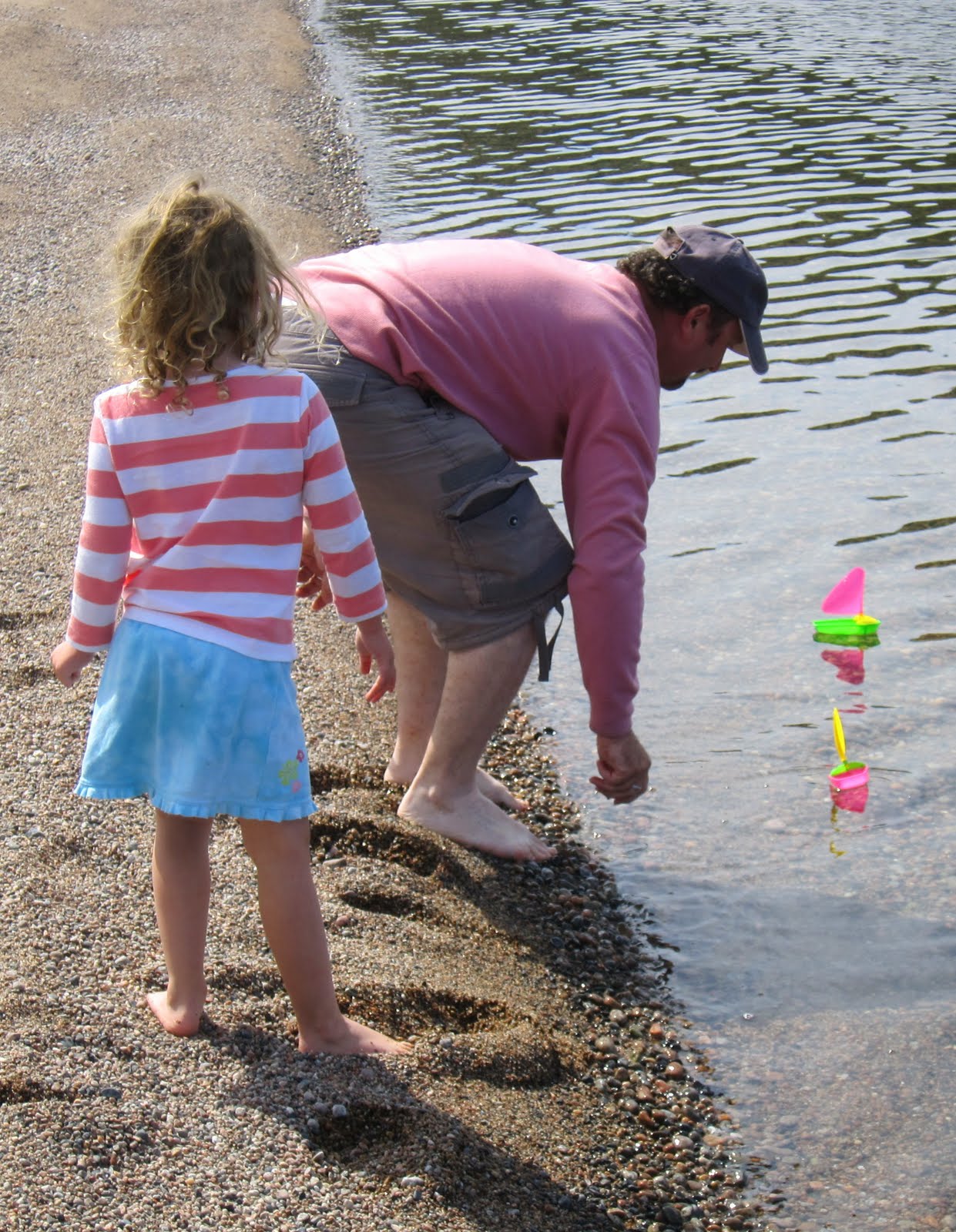
Sailboats Along Lake Ontario
Distance: 196km
Average Speed: 25.8km/h
Maximum Speed: 71.2km/h
Time: 7:36
Odometer: 4781km End of Trip!

Tuesday 5 July 2011

Day 37, July 5th, Tobermory to Owen Sound, (145km)

Georgian Bluffs Along Georgian Bay
Yesterday, on the Chi-Cheemaun ferry, a local said it best.  "Take the scenic routes it's worth the extra miles."  Today his words came to fruition.  I'm really not in a rush to get to Toronto.  Heading out on highway 6, I found PJ's Country Restaurant for breakfast just outside Ferndale.  PJ was awesome.  Breakfast was huge and she knew the area.  "This is beautiful country," she said.  "If you really want to see it take Highway 9 along the coast.  Just turn left at Ferndale."

Wind Power and Hay Fields
The scenery on Highway 9 turned out to be phenomenal.  This part of Ontario has had optimal weather for growing crops this year.  Canola fields were brilliant yellow and the hay fields were being harvested.  Every now and then, Lake Huron would come into view.  Farmers waved, not many bike tourers go this way.  A farmer filled my water bottles when I stopped for a chat.  The road was a bit longer but its definitely worth the ride.  I would recommend Highway 9 to any bike tourer riding the Bruce peninsula.  

Taking a Break Along Georgian Bay
Eventually, Highway 9 got me to Wiarton.  Stopping by Rexall to top off my supplies, the cashier gave me another great piece of advice.  She suggested taking Highway 1 through Grey County along the coast all the way to Owen Sound.  While it was a lot longer, she said the view of the Georgian Bluffs was worth the ride.  Highway 1 didn't have a shoulder but there were only a few cars along the road.  Skirting the coast, the bluffs appeared on the far side of the lake.  It was so beautiful.  Taking my time, I headed down to the boat launch to take some pictures.  Walking along the beach, I had the whole place to myself.  It was too hot to ride so I jumped in the lake.  What an awesome feeling on a muggy day.  

Highway 1 Rolling Down to the Coast
Wanting to make it to Owen Sound, I moved on.  Highway 1 bends inland over a steep hill close to Indian River.  I climbed the hill and looked back at Georgian Bay.  The fellow who owns the farm must have the most pictures-tic farm in Canada.  Rolling into Indian River, I discovered a General Store.  The lady running the place is famous for having the best butter tarts in Ontario.  People drive here from all over the place to buy them.  I ended up buying a dozen.  There's still a few left for breakfast but they might not make it till morning.  The locals at the trailer park I'm camped at know where I bought them.  

Canola Fields In Full Bloom
Not far from Indian River, is Owen Sound.  It strikes me as a tough and gritty city.  Perhaps I just came through the wrong part of town.  Right down to the architecture, the downtown core reminded me of the Eastside of Vancouver.  There were even a few drug attics out and about.  Lunch down here was really cheap.  For some reason, when you order a slice of pizza they give you two.  The girl at the tourist information center was the friendliest I've met on this trip.  She helped me contact a trailer park outside the city to check to see if camping was available.  Camping was available and Donna gave me a tenting site for half the normal price.  The residents who call this park home are nice people.  A lot of them are down on there luck or older seniors with no where else to go.  I'm kind of incongruous with the surroundings but everyone is so friendly that the place feels like home.  

Hayfields by Owen Sound Along Highway 1
Tomorrow I'm not sure what to do.  I saw a sign saying Toronto is 185km away but there's a lot of hills by Orangeville.  If there's no campgrounds I might push into town.  Highway 10 is reputedly busy without much of a shoulder.  It's gonna be strange being in the big city after spending weeks in some really remote parts of Canada.  It's only during the past couple of days that I've realized this adventure is nearing its end. 

Toronto is so Close Now
Distance: 145km
Average Speed: 21.9km/h
Maximum Speed: 56.6km/h
Time: 6:50
Odometer: 4585km

Monday 4 July 2011

Day 36, July 4th, Sheguiandah to Tobermory (58km)

Chi-Cheemaun Ferry

Last night the campground was hopping. With Canada Day on Friday and Independence Day on Monday, a lot of people had made it a 4 day weekend. Batman Campground is huge, it must have over a hundred sites. At the rec hall I met a lot of people. Word spread quickly that I was the guy on the bike from Vancouver. Kids love good stories and adults like adventure. So many people came by to say hello.  Throughout this whole trip, I've been lucky to hear a lot of great stories from friendly people.  It was tough to escape the crowd and I didn't get back to my tent until well past midnight. The ferries sailed from South Baymouth at 7:30am or 1:30pm.   I chose to sleep in and catch the later boat. The terminal was only 52km away.

Manitoulin Landscape
In the morning, an old timer told me I would have a breakfast hill to warm up my legs.  It wasn't too bad and after the hill, Manitoulin Island flattened out. This island is the largest freshwater island in the world. You can see the lake along the side and beautiful rolling hay fields.  The roads weren't busy and the construction crews were friendly.  I really enjoyed the ride to the terminal along its quiet roads. The ferry I'm taking takes you from South Baymouth to Tobermory across the channel between Georgian Bay and Lake Huron. It's almost a 2 hour ride.

I got to the terminal an hour before the ferry. It was already full. So many people were heading home after a weekend at the cottage. There's always room for a bike so I purchased a ticket and went to the front of the line. I saw another guy with a couple of bikes. He had been in Manitoulin for a triathlon on the weekend. He gave me directions on how to get to Toronto from Tobermory. I'm only 308km away. “The hills are done,” he proclaimed.  

Chi-Cheemaun Heading Towards Tobermory
The ferry ride was beautiful.  From the cafeteria, you could see the islands in Georgian Bay.  Cutting close to a lighthouse we rounded the bend.  Tobermory appeared in the distance.  I went down to the car deck to untie my bike.   A bunch of bikers came by to say hello.  Bikers seem to relate well to cyclists.  We both know what it's like to have total freedom on the roads.  It's really quite a diverse group out here.  You have the tough acting, foul mouthed red necks riding their choppers but also well spoken doctors looking for new adventures.  On the road we all get along.  I guess the glue that binds us together is the great adventure.  A few days ago, I said you are who you are in the moment when your traveling this way.  As I watched a redneck help a doctor with his bike, that statement couldn't have been more true.  In the city these two would have never talked.  Out here, it was like they had been friends for the past twenty years.

A Few Bikes on the Ferry
First off the ferry, I pulled into the information center.  I didn't want to battle the ferry traffic on a tight country road.  The girl said there wasn't much between the 100km stretch from Tobermory to Owen Sound.  She suggested a campground run by Mennonites at the southern edge of town.  After a week of tough riding, I wanted a break.  It was only a 58km day. Toronto is just over 300km away now.  In so many ways, I don't want the adventure to end.  Tonight I talked with a couple who's son has been posted to Sierra Leon with the Peace Corps.  The pictures were awesome.  Happy 4th of July to all my American friends.  

Leaving South Baymouth
Distance: 58km
Average Speed: 19.6km/h
Maximum Speed: 47.1km/h
Time: 2:58
Odometer: 4440km


Day 35, July 3rd, Blind River to Sheguiandah (174km)

Amish  Cart & Buggy

Sitting down at Tim Hortons for dinner last night, Joseph came by to say hello. At first I was a bit surprised, Joseph is Amish and they have a reputation for being reclusive. He'd been in Blind River all day at the farmers market trying to sell his wares. Joseph makes wooden furniture and grows berries and vegetables on his 85 acre farm. Originally, he said a lot of Amish had settled on Manitoulin Island. Land is more expensive there, so 5 young families relocated to Iron Bridge. Life was difficult but they were going to give it a try. Waiting for the Grayhound to take him back, he asked if I saw any horse and buggies today. I mentioned the carriage I had seen at Iron Bridge near the store. He said that was probably his wife, she bakes and sells homemade bread. Joseph and I are about the same age and I was glad to get a better understanding of their culture. According to him, he wouldn't want to live any other way. 

I think what Joseph believes is important.  While some may consider him crazy he feels he lives in a historical period where there's enough technology to serve the needs of man.  Perhaps for him it's the ideal balance between our wants and needs.  He has time for his family and the kids.  The clock he lives by is the sun in the sky.  He's a happy fellow unburdened by the wants of consumerism.  While I would never choose his lifestyle, I can understand the allure of simplicity.  With dinner finished, he wished me the best of luck. He told me to look out for the horse and buggies going west in the morning. We shook hands and I took off. The sun was setting and camp was 5km out of town.

Serpentine River
Today my goal was to reach Espanola. Espanola is a pulp and paper town that also serves as the junction for Highway 17 and Highway 6. I plan on going south on Highway 6 and taking the Manitoulin Island ferry to Tobermory.  At just over 100km, the ride to Espanola should have been easy. It was another sunny day. The morning was hot but the winds were calm and I cruised smoothly through the rolling hills. I crossed a bridge over the waterfall on the Serpentine River. Things were going great. The heat was intense so I took lots of breaks. Cruising through a series of small towns, I made it to Spanish.  Espanola was less than 30km away.

Highway 6 Breaking Off to the Right
After taking a break, I battled a few more hills before arriving at the junction of Highway 17 and Highway 6. I can't say I'll miss Highway 17. It's a dangerous road to cycle on. Right until the end, the shoulder was narrow. When there was a shoulder, it was often chipped or the cracks would be filled with soft rubber that catches your wheels. Motorcyclists have the same problem. The rubber they use to fill the cracks wobbles their bikes. As I paused at the junction, a guy waved me in to Tim Hortons. He bought me an Ice Cap. I'm still amazed at all the acts of random kindness that I've experienced on this trip. 

Entering Espanola, you see a massive paper mill. “More Than a Nice Paper Town,” is what the sign says. High and low I searched for somewhere to camp. The guy at Mcdonalds said there was nothing near the town. He suggested I make the trip to Manitoulin Island. It was 60km down the road and late in the day. Without much choice, I started the journey. The kid had said there might be a few small hills along the way.

Grinding up a Hill
A few small hills turned out to be the LaCloche foothills. Sharp and steep, they reminded me of the shoreline of Northern Lake Superior. The heat radiated off the pavement like a blast oven. It was tough to climb in these conditions. After a 25km struggle, I made White Fish River. The sign said this was reservation land. Rolling past the community center, an Indian came out and asked me to stop. “I have a vision,” he said, “you come from a land many moons away.” I couldn't tell if he was joking, so I said, “The land you speak of is surrounded by mountains that descend to the sea. The white man calls it Vancouver and it's 35 moons away.” The Indian introduced himself as Rising Mojo.  It's the most interesting name I've come across on this trip. He said he wanted to buy me a drink. I told him that “The 36th moon wasn't far away and that I still had a long way to go today.” He told me “No harm would come to me as I went through White Fish River lands.” Rising Mojo blessed my trip. He couldn't stop saying "For real bro," when I told him of all the things I'd seen. I think he thought I was Indian. It was such a funny chat but he was a nice guy.  

Oh La La! La Cloche Hills
The land flattened out and I hit Swift River. Stiff headwinds greeted me for the rest of the way. At Swift River, they said the next campground was at Sheguiandah. I kept pushing forward. Finally making the campground I greeted the girl, “Glad to see you Batman.” The name of the campground was Batman and it's a good one. A lot of regulars come here from as far away as Toronto. I'm getting very near. Tomorrow I take a 2 hour ferry to Tobermory.

Manitoulin Island Landscape
Distance: 174km
Average Speed: 20.9km/h
Maximum Speed: 58.4km/h
Time: 8:19
Odometer: 4382km

Saturday 2 July 2011

Day 34, July 2nd, Sault Ste. Marie to Blind River (156km)

Got Em! West of the Soo
Canada Day in Sault Ste. Marie!  The fireworks were on display by the river.  For almost an hour, they boomed in the distance.  Everyone was in a happy mood.  My neighbours were 2 Americans riding their choppers.  They were going to Vancouver and then down to California.  A couple of patch wearing gangsters came by for a chat.  They loved hearing stories of my trip.  On the road, you are who you are in the moment.  Sometimes you make the strangest friends.  Drinking with gangsters on Canada day...

View of America
The night was pretty warm.  The roar of my neighbours bikes woke me up early. By 5am, they were on the road. I packed up my tent and checked out the city.  The harbour was beautiful and across the bridge was the American Sault Ste. Marie.  No soldiers, no guns, no sentries on boats.  Hope it never changes.  A local cyclist came by for a chat so I picked his brain.  He told me to take highway 17b out of the city for a safer ride.  This mornings route goes by little towns with interesting names.  Bruce Mines, Thessalon, Iron Bridge and Blind River were the towns I cycled through today.

Land Disputes
Recently, highway 17b has been a source of conflict.  It runs through the Ojibway's land.  Early last year, when the Ojibway Nation faced a million dollar budget shortfall, they publicly warned about imposing tolls on highway 17 and highway 17b.  It was a spark for trouble.  Bored young men, both white and Indian, with nothing to do, defaced the signs along this stretch of road.  Racist comments smeared across the signs do little to ease the tension in this part of the country.  Rolling through the reservation, I stopped for some water.  The guy at the station was really interested in bike touring too.  Friendly and helpful, he passed on advice about the terrible shoulder down the road.

Bruce Mine
My first major stop was Bruce Mine.  In 1846, this was Canada's first copper mine.  It was named after the governor general of the day.  Today the mine is decommissioned and up until recently the town had fallen into disrepair.  A lady in the town said the mayor had recently spent a lot of taxpayers money.  Half completed construction projects were everywhere.  The town was furious at the reckless spending and the mayor was booted out of office. Now the projects are on hold.  It seemed like such a waste of money to see so many projects half completed.  The citizens of the town say the increase in property tax was unbearable so the new mayor has halted all construction pending review.  This town is a magnet for tourists.  Southern Ontarians come here to escape the hustle and bustle of the big cities. 

Lake View Near Thessalon
Thessalon was the next town along this route.  I was riding through flat prairie.  It looks like I'm exiting the Canadian Shield.  At Thessalon you can see Lake Huron.   It's a massive lake.  Water stretches all the way to the horizon.  Thessalon is a transportation junction between highway 17 and highway 129.  Today it's known for it's fishing.  Boats line the beautiful river along the road out of town.

Amish Horse & Buggy
With strong tail winds behind me, I flew down to Iron Bridge.  The town was named after the iron bridge built over the Mississagi River.  In the 1940's, a concrete bridge replaced it.  The name of the town was never changed.  Something that has never changed is the way of life of Menonites and Amish who live in the area.  With a horse and carriage they roll through the town.  They're completely incongruous with their surroundings.  Even the bridge is steel and concrete these days.  It was a fascinating scene, so I stopped for a picture.

Hayfields Near Blind River
26km East of Iron Bridge is Blind River.  This town owes its name to the Voyageurs.  These legendary canoeists named it Blind River because the mouth of the river wasn't visible from their canoe route through the area.  The town used to rely on logging.  Cameco also had a huge uranium mine at Elliot Bay.  Today both industries are gone and the town is shrinking.  Tonight I'm at Macivers Campground at the edge of the city.  For 65 years, the same family has operated the resort.  Wayne's an awesome guy.  We had a long conversation about business and the death of the travel industry in this part of Ontario.  His list of grievances is long.  He no longer see's families with RV's or American tourists.  The price of gas and the high dollar is keeping everyone away.  People no longer snowmobile in the Winter.  We are losing our connection with nature.  Society would rather enjoy the comfort of the virtual world.  Wayne's son is studying hospitality and tourism.  Wayne figures that after 65 years it might be time to do something else.  Bike tourers love the campground here.  It would be sad to see it go.  I guess we could always camp down by the river, but it wouldn't be the same without Wayne.

The Harbour Sault Ste. Marie
Distance: 156km
Average Speed: 23.8km/h
Maximum Speed: 47.7km/h
Time: 6:33
Odometer: 4208km

Friday 1 July 2011

Day 33, July 1st, Montreal River to Sault Ste. Marie (124km)

Last Nights Sunset
To get to Sault Ste. Marie from Thunder Bay, you take Highway 17 East for 697km along the shores of Lake Superior.  The terrain is diverse and the scenery's beautiful.  Sault Ste. Marie is at the Eastern end of the Northern shore and marks the end of the major hills.  Waking up on the shore of the lake, I could hear the howling wind.  Overnight, the clouds in the distance had blown across the lake.  I packed up camp and thanked the guys with the canoe.  Without them, there would have been no dinner.  I wanted a good meal for breakfast.  Hmm... Pancake Bay, with a name like that, I expected the best.  Hundreds of years ago, the legendary Voyageurs would stop for breakfast here.  They would use the last of their flour to make pancakes before the final push into Sault Ste. Marie.  I made my way back through the forest.  Back on the road, I hit a supersized hill.  This highway makes you work for everything.  I would have to earn my breakfast on the way to Pancake Bay,

Beautiful Scenery Lake Superior
The hill wasn't really the problem.  The roaring sounds of relentless headwinds in your ears is demoralizing.  While the road from Thunder Bay to Sault Ste. Marie is a hilly, physically difficult challenge, the winds present the most formidable physical and psychological obstacle.  After reaching the summit, I pedaled down the hill.  Reaching the mighty speed of 25km/h, I sighed in exasperation.  Who needs brakes when the wind blows so hard I thought.  With the wind roaring in my ears, I fought my way to Pancake Bay. 

Tepees at Pancake Bay
Tepees appeared beside the road.  Ahh... civilization.  It had been almost 150 hilly kilometers with barely a store or a gas station.  I was happy to get to Pancake Bay.  The Agawa Indians run a great business.  You can buy their furs, shop for groceries or a souvenir.  Over 200 North American carvers are represented in their stores.  What was missing was a restaurant.  I resigned myself to breakfast from the grocery store.  The provincial parks could learn a lot from the Indians.  At over $35 a night the camping is expensive in Ontario's parks.  If you do spend $35, you might not even get showers. Employees mill around with nothing to do.  Thanks but no thanks, I'd rather free camp on the shores of the lake or support a private campground with friendly owners offering twice as much for half the price. We need to do better.  There is a disconnect between the government and the patrons of the parks.  The parks are beautiful, but scenery aside, the lack of facilities a exorbitant price give tourists little reason to stay.  In a world where cheap flights have made beautiful places more accessible, Ontario will lose its tourists if continues to fail to connect with those who want to enjoy the outdoors.  It was embarrassing to hear nothing but continuous complaints from international tourists unhappy with the facilities and the crazy price.  If the administrators so out of tune with reality, now would be a good time to make a change. Rant over...

Chippewa Water Fall
Leaving Pancake Bay, the roads stayed flat but the wind continued to howl.  Riding by the lake was beautiful. Small chip stands and grocery stores dotted the shore.  Beautiful little islands appeared beside the road.  For a minute or two, the lake would disappear.  Rounding a corner, it would come back into view.  A completely different portrait would appear before your eyes.  You had to constantly remind yourself you were still riding beside the same massive lake.  I slowly passed a waterfall.  Chippewa waterfall was right beside the road.  I paused to stop.  This road gives you so many reasons to take a break.

The Start of 1 Mile Hill
Stopping for a snack, I asked the friendly lady about the last 20km to the Soo.  With great enthusiasm, she warned me about One Mile Hill.  One Mile Hill is legendary.  There's a story about a cyclist who rode all the way across Canada, saw the hill, gave up and turned back to go the other way.  I got back on my bike and within 5 minutes I was at the base of the hill.  The  higher I climbed, the steeper the hill seemed to get.  In my head, I thought this would be the perfect training site for a sadistic running coach.  Hitting a mile, the hill still continued up but flattened out.  At 2.5km the summit finally appeared.  After the summit, I slowly coasted the rest of the way to Sault Ste. Marie.  Pulling in at a restaurant, I had a chat with Scott.  Scott's on his way to start a new life in Port Moody and left a week ago from Quebec.  I told him how spectacular and remote the 697km is to Thunder Bay.  Then I told him about the hills.  Scott's riding himself into shape.  He'll be a new man by the time he hits Thunder Bay.  I gave him my email, wished him good luck an yelled, "See you in Vancouver in 40 days."

For 697km, It's Been a Beautiful Ride Along Lake Superior
Distance: 124km
Average Speed: 18.8km/h
Maximum Speed: 58.1km/h
Time: 6:36
Odometer: 4052km

Day 32, June 30th, Wawa to Montreal River (111km)

Calm Winds Outside Wawa

As beautiful as Canada is, one of the great experiences of this trip is meeting unique and interesting people. Everyone has a story to tell and the stories out here are unbelievable. Yesterday, I met Umair. Umair has a dark complexion and long black hair. He's the type of guy who could be from anywhere. Spotting me from across the road, he crossed over.  Umair had just done his masters and is riding his bike from Toronto to Vancouver over 40 days. We were doing the same route going opposite ways. I learned from Umair that next year he'll ride from Paris to Lhasa. With an interest in language, he plans to study Chinese dialects along the way.

Old Woman Bay
Today's ride took me through Lake Superior Provincial Park. After the long day yesteday, I hadn't looked at a map. A group of boys at the camp doing missionary work cooked up a good breakfast. The guys were in their teens and were hungry to hear good stories. They told me about Daryl who is a day or two ahead. He has a GPS that continuously updates his location on his blog. After breakfast, the guys gave me some Cliff Bars. It was already late when I set off for the Lake Superior Park.

Danielle and Her Dad
Entering the park, I saw the sign. Lake Superior Provincial Park was 83km long. In provincial parks, there's no stores to buy supplies. Great! I had 3 cliff bars and 3 liters of water, It was going to be a difficult ride. The hills were steep. After a gruel-ling ascent, I zoomed into Old Woman Bay. Danielle and her dad were by the water. Danielle's dad was going through an ugly divorce and happy to have time to spend with his daughter. Maybe after the divorce he might do a trip. He's thinking about biking across Canada so he had a lot of questions. He offered me some extra supplies before I resumed my trip.  I thankfully accepted a lot of water.  It's so ironic to run out of water beside a lake. 

I left Old Woman Lake and climbed the hill to the park office. Not familiar with the terrain, I asked for a profile of the road ahead. The helpful girl said there would be more hills and that I should be ready for a difficult climb up Montreal Hill before Montreal River. Descending from the office, a man appeared out of the brush beside the road. I was kind of curious so I stopped for a chat.

Descent Into Christine Bay
Dana Meise has a really interesting story. A little while back he received a promotion at his job. With the promotion, he would have been stuck in the same position for perhaps the rest of his life. Instead of accepting, he quit his job, sold his house and started to walk. People called him crazy, he had worked so hard to get the promotion. Dana started in Newfoundland and over 8000km later, I was talking with him at the side of the road. His goal was to walk the entire Trans Canada Trail. At 22 000km it's a bit of a hike.  The trail was washed out in this part of Ontario and after struggling for several days, Dana detoured through the park. Michaelle Jean the former Governor General and Lauren Harper the Prime Minister's wife had heard about his trip. They had spent some time to walk with him. His trip has taken on a life of its own. Now sponsored by the Trans Canada Trail http://www.tctrail.ca./home.php and Keen Shoes http://www.keencanada.ca/ca/en/, Dana will spend the next 7 years to complete the hike. He has a GPS that records his real time position on the internet. For more information, check out www.thegreathike.com As far as I know, Dana will be the first person to walk the entire trail. He's an amazing guy with an amazing dream. I hope one day I run across him again as he walks through the Trans Canada Trail into Vancouver.

Beautiful Desolate Beach, Christine Bay
After the chance encounter, I continued my ride. It was already afternoon and the sun was hot. Montreal River was still 50km away. My ride took me past Christine Bay. With no one by the water, I paused for a little lunch. Climbing more hills I finally made Agawa Bay. I talked to a biker at the rest stop. Yesterday, a deer had clipped his motorbike. He had gone down and the bike slid across the road. He was missing his windshield and a turning signal. The mechanic who fixed his bike said it happens quite often. Ditch rats is what they call the deer out here. Descending from the viewpoint I entered the provincial park campsite and filled up my bottles. The camping fee of $35 plus tax is a little steep. The girl at the office mentioned it was a 57km ride to Banana Bay. At 3pm it was too late. I set off anyways, hoping to find something in Montreal River.

Welcome to Montreal River
For weeks, I had heard about Montreal Hill. Dana had mentioned the big hill after Agawa Bay. Umair had said there was some nasty hills after the park. In Winnipeg, the guys at the hostel all remembered this hill. In the hot afternoon sun, I started my climb. It was steep and long and my legs were dead. I just kept ploughing forward. It took a while, but I finally hit the top. I had gone through 1.5 liters of water climbing this hill. With the summit behind me, I started my quick descent. A sign saying Montreal River appeared beside the Road. Montreal River isn't even a town. Distracted by the sign, I didn't notice the black rubber used to fill the cracks in the road. The rubber caught my tire and my bike wobbled really bad. I was able to recover and kept it from crashing. This black rubber is really dangerous to cyclists. It can clamp onto your wheel like a vice.  I counted my lucky stars.  At the time I hit the rubber, I was going at my maximum speed for the day. 

Sunset on Lake Superior
Not a town in sight and it was late in the day.  I briefly checked out Twilight resort but it was a rag tag place along the lake.  The great thing about Lake Superior is there are so many beaches along its shore. Walking through the dark forrest then along the shore, I found a nice little spot not far from the road and resort.  I set up on the rocky sand.  A night on the beach beside the lake.  Sunset was beautiful, and I met some guys with a canoe.  I swam in the lake to wash away the sweat.  Since breakfast, I haven't had a proper meal and I'm out of supplies.  It's going to be interesting to see what's left in the legs for tomorrows trip to Sault Ste. Marie.

Parks Building Lake Superior Provincial Park
Distance: 111km
Average Speed: 18.8km/h
Maximum Speed: 48.4km/h
Time: 5:52
Odometer: 3928km